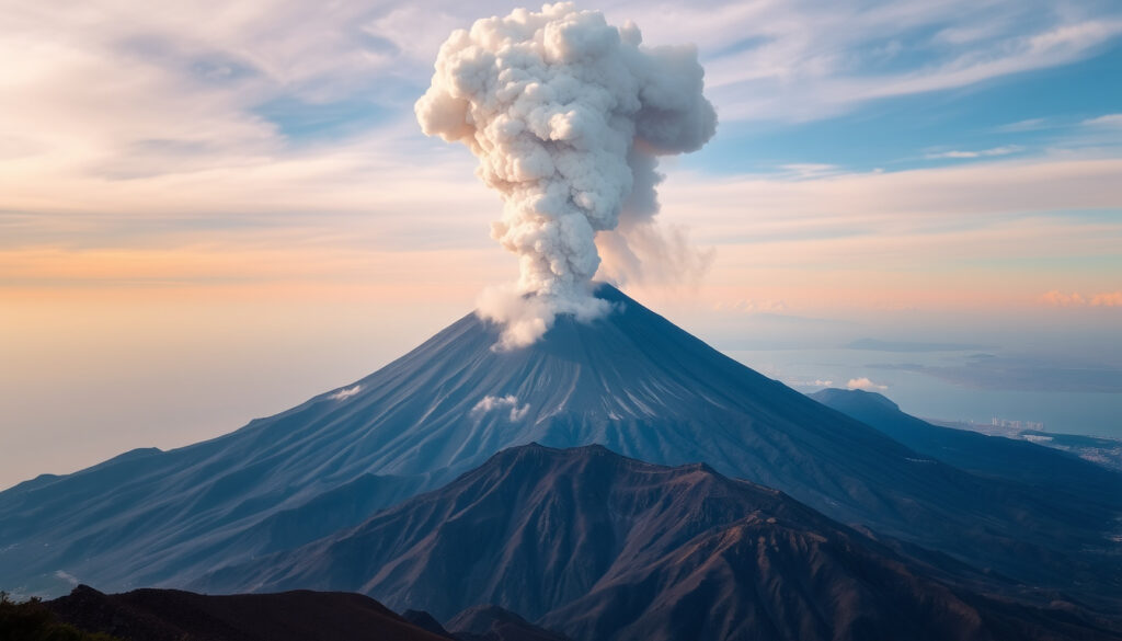
Mount Vesuvius: Active Volcano, Climbing & Eruption History
Most people meet Vesuvius through Pompeii’s haunting ash casts — the moment a Roman town was frozen in time, but the volcano that buried Pompeii in 79 AD is still officially active and looms over Naples. This guide separates the myth from the monitoring data, walks through the 1944 eruption that shaped today’s risk plans, and covers what climbing the crater is actually like now.
Last major eruption: 1944 ·
Height: 1,281 m (4,203 ft) ·
Type: Composite stratovolcano ·
Location: Campania, Italy ·
Status: Active, monitored by Vesuvius Observatory ·
79 AD deaths: ~1,500–2,000 (Pompeii and Herculaneum)
Quick snapshot
- Vesuvius is an active volcano, and its most recent eruption was in 1944 (Earth Magazine (geoscience press))
- The 1944 eruption destroyed San Sebastiano al Vesuvio, Massa di Somma and Ottaviano (Wikipedia (Mount Vesuvius entry))
- Will the next eruption be explosive or effusive? Unknown — and the 1944 event showed Vesuvius can do both inside a single eruption (British Journal for Military History (peer-reviewed study))
- The quiet since 1944 is the longest repose period since the one that ended in 1631 (Michigan Tech (Vesuvius eruption archive))
- The 1944 paroxysmal phase ran from 18 March to 4 April (Smithsonian Global Volcanism Program (global eruption database))
- The current repose keeps all eruption scenarios open — the next phase is being watched, not predicted (Michigan Tech (Vesuvius eruption archive))
Six numbers capture what Vesuvius is: a mid-size Italian volcano with a violent history and a monitoring network that treats it as a permanent live case.
| Label | Value |
|---|---|
| Last eruption | 1944 (Italy’s Civil Protection Department (national risk agency)) |
| Height | 1,281 m (4,203 ft) (Smithsonian Global Volcanism Program (global eruption database)) |
| Type | Composite / stratovolcano (Smithsonian Global Volcanism Program) |
| Location | Campania, Italy (Smithsonian Global Volcanism Program) |
| Monitor | Vesuvius Observatory (Osservatorio Vesuviano) (Italy’s Civil Protection Department) |
| Fatalities (79 AD) | ~1,500–2,000 in Pompeii and Herculaneum (Wikipedia (Mount Vesuvius entry)) |
Is Vesuvius likely to erupt again?
The short answer: yes, eventually. The historical record shows significant eruptions arriving roughly once a century (Earth Magazine (geoscience press)), and the useful question is where the volcano sits in that cycle today.
Current volcanic activity status
- Since the 1944 eruption ended, Vesuvius has been in a quiescent stage with low seismicity and fumarolic activity — still the position at the start of 2026 (Italy’s Civil Protection Department (national risk agency)).
- Scientists describe the volcano as quiet but not retired; the current silence is historically unusual, not historically reassuring.
The official reading is calm but not casual. A dormant stratovolcano sits nine kilometers from Naples, and the monitoring network treats that distance as the reason to never switch off.
Monitoring systems and warning signs
- The Vesuvius Observatory (Osservatorio Vesuviano) runs continuous surveillance of gas emissions, ground deformation, and seismic activity.
- Alert thresholds respond to changes in those measurements, not to calendar dates or public anxiety.
The warning playbook is standard volcano science: changing gas composition, ground deformation measured in millimeters, and swarms of small earthquakes. None of those signals is currently at a level that worries the monitoring network, and the official position stays calm but alert.
The logic is the same as a weather-radar network: sensors detect small changes early because the institution watching them never sleeps. For a step-by-step look at how real-time sensor networks turn raw data into warnings, our Met Office rainfall radar guide explains the mechanics.
Vesuvius is arguably the most closely studied volcano in Europe, and the reason is simple: an active crater nine kilometers from Naples doesn’t get the luxury of privacy.
What this means: the 2026 answer is “not right now,” but Vesuvius has never worked on a published schedule. The monitoring exists precisely because quiet phases are not guarantees.
The pattern: long monitorable gaps define the risk, and the data says the mountain is asleep, not dead.
Is Vesuvius still an active volcano?
Yes — and the exact wording matters. “Active” is a technical status, not a panic button.
Definition of active volcano
- An active volcano still has a magma system capable of producing future eruptions; a dormant volcano is active but currently quiet.
- The Smithsonian Global Volcanism Program classifies Vesuvius as an active stratovolcano (Smithsonian Global Volcanism Program (global eruption database)).
Vesuvius sits within the Campanian volcanic arc, a crowded volcanic neighborhood that also includes the Phlegraean Fields west of Naples. The line between “active” and “erupting” is the practical boundary that lets the city function.
What the eruption record shows
- The 1944 eruption ended Vesuvius’s open-conduit phase; activity since then has been limited to low seismicity and fumarolic emissions.
- The gap since April 1944 is the longest quiet stretch since the 17th century.
Vesuvius’s cone is a composite of layered lava, ash, and pumice — the built-up record of eruptions between quieter periods. “Active” is the correct label, “dormant” is the correct behavior, and “extinct” is wrong on both counts. The pattern: Vesuvius is not a museum volcano — the geology that produced the 79 AD catastrophe is still present, still warm, and still under permanent observation.
How hard is it to climb Vesuvius?
Hard enough to feel earned, easy enough for most active walkers — the crater trail is a hike, not a climb.
The trail in brief
- The main route from the upper parking area to the crater rim runs about 2 km with a steady, moderate incline.
- Most visitors need 30–40 minutes one way; the descent is quicker but demands care on loose ground.
- No climbing equipment or previous experience is required — the challenge is volcanic scree near the top, not technical terrain.
Getting there from Naples
- Public buses and organized tours connect Naples, Pompeii, and Ercolano to the entrance on the volcano’s flank.
- Guided tours are optional; the marked path reaches the rim on its own.
- The trail can close in bad weather or when volcanic-risk levels change, so checking official status comes first.
From the rim, the reward is a 360-degree panorama: the Bay of Naples, the islands offshore, and the mountain’s own crater basin opened by the 1944 eruption — a perspective that makes the volcanic risk feel abstract for a moment. If you enjoy mapped-out travel planning, our Beyond Paradise filmed locations & map guide uses the same route-planning approach for a very different destination.
The crater edge is unfenced in stretches, and the inner slope is steep volcanic debris. Stay on the marked path — the rim doesn’t look like a cliff until you’re at it.
The trade-off: Vesuvius rewards the effort with one of Europe’s most dramatic urban views — but the mountain, not the tour operator, decides when the trail opens and closes.
The implication: the climb is accessible but respect the terrain and the advisory.
How many people died when Mount Vesuvius erupted in 1944?
The toll was 26 — dramatically lower than 79 AD — and the reasons explain a lot about how the eruption actually behaved.
The 1944 eruption in numbers
- Twenty-six people died, most of them killed by falling rock and ash, and thousands were forced to leave their homes (BBC World Service (historical retrospective)).
- The eruption rated 3 on the Volcanic Explosivity Index and ejected roughly 0.01 cubic kilometers of material (Earth Magazine (geoscience press)).
- According to the British Journal for Military History, lava spilled over the crater rim at 16:30 on 18 March, and by 30 March activity was back inside the crater — a three-week sequence that also dusted Allied airfields with ash (British Journal for Military History (peer-reviewed study)).
- The same study estimates 35–40 million cubic meters of magma erupted in fewer than 12 days.
The common summary that 1944 was “all ash, no lava” is wrong. Lava flows destroyed several villages in the days before the explosive peak — the death toll stayed low because the early lava stage moved slowly enough for people to evacuate.
Why 1944 still matters
- It ended the open-conduit phase that had defined Vesuvius for centuries and began the quiet period that continues today.
- It is the reference event for current planning: the same pattern of slow lava followed by explosive pulses is the scenario civil protection prepares for.
The implication: modern Vesuvius planning is not built around a Pompeii repeat as the only possibility — it is built around the realistic mix of slow lava and sudden explosive bursts that 1944 actually displayed.
The pattern: 1944 shows that even a moderate eruption can reshape the landscape and the risk planning that follows.
Would Naples be destroyed if Vesuvius erupted?
The honest answer is “it depends on the eruption’s size” — and that is a more useful answer than a simple yes or no.
How close is the danger zone?
- Naples sits about nine kilometers west of the crater — close enough that a large Plinian eruption would put parts of the city in the path of pyroclastic flows.
- The most lethal hazard is not lava but pyroclastic density currents: fast-moving mixtures of gas, ash, and rock that can cross that distance in minutes under the wrong conditions.
- An effusive eruption in the style of 1944 would be a serious local disaster but not a city-ender.
The evacuation plan
- The “Red Zone” evacuation plan covers 25 municipalities and roughly 600,000 residents (Italy’s Civil Protection Department (national risk agency)).
- The strategy is to move people out before an eruption reaches a critical phase, using pre-planned transport rather than improvisation.
- The Phlegraean Fields west of Naples, a separate caldera with documented ground movement that scientists continue to track, keep the regional risk picture wider than Vesuvius alone.
By raw explosive power, Vesuvius is not in the same category as the planet’s most dangerous volcanoes — a Yellowstone supereruption would affect global climate, and Tambora’s 1815 blast caused the “Year Without a Summer” — but Vesuvius ranks higher in real-world risk because of its address next to a metropolis.
The 1944 eruption was only a VEI 3 — yet it destroyed villages and displaced thousands. Scale that energy upward, and the existence of a 600,000-person evacuation plan stops looking excessive.
What this means: Naples shares its metropolitan area with an active volcano, and the city manages that fact with one of the most developed civil-protection systems in the world. The risk is real, measured, and planned for — which is a different situation from living with an unpredictable one.
What is the deadliest volcano in the world if it erupts?
By raw explosive power, a Yellowstone supereruption would affect global climate, and Tambora’s 1815 blast caused the “Year Without a Summer” — but Vesuvius ranks higher in real-world risk because of its address next to a metropolis. The deadliest volcano label depends on whether you measure explosive force or human exposure.
Mount Tambora (1815) ejected over 160 km³ of material and killed at least 71,000 people, mostly through starvation. Krakatoa (1883) produced the loudest sound in recorded history and killed 36,000, mainly from tsunamis. Yellowstone’s supereruption 640,000 years ago covered half of North America in ash, but the recurrence interval is hundreds of thousands of years. Vesuvius, by contrast, has a modest VEI but sits next to 3 million people in the Naples metropolitan area — making it the most dangerous volcano in Europe by proximity.
What volcano is most likely to erupt in 2026?
According to global monitoring networks, volcanoes such as Mount St. Helens (USA), Kilauea (Hawaii), and Popocatépetl (Mexico) show signs of unrest. In Italy, the Phlegraean Fields west of Naples have experienced increased ground deformation and seismic swarms, prompting the civil protection authority to raise alert levels from green to yellow in 2023 (Italy’s Civil Protection Department). Vesuvius itself remains quiet, but its repose is historically long, meaning the possibility cannot be discounted.
Mount Vesuvius at a glance
Nine technical specs, one pattern: the numbers that make Vesuvius frightening are the same ones that make its behavior measurable.
| Spec | Value |
|---|---|
| Height | 1,281 m (4,203 ft) (Smithsonian Global Volcanism Program) |
| Volcano type | Composite / stratovolcano |
| Last eruption | 1944, 18 March – 4 April (Smithsonian Global Volcanism Program) |
| Eruption style (1944) | Effusive lava flows followed by explosive pulses |
| Volcanic Explosivity Index (1944) | 3 (Earth Magazine) |
| Material ejected (1944) | ~0.01 km³ (Earth Magazine) |
| Magma erupted (1944) | 35–40 million m³ in under 12 days (British Journal for Military History) |
| Summit crater | Reshaped by the 1944 eruption; deepened by roughly 300 m (Smithsonian Global Volcanism Program) |
| Distance to Naples | ~9 km (Italy’s Civil Protection Department) |
| Red Zone coverage | ~600,000 residents across 25 municipalities (Italy’s Civil Protection Department) |
| Monitoring | Vesuvius Observatory (Osservatorio Vesuviano), continuous surveillance |
The pattern: this is a mid-size volcano with a metropolitan neighbor — its risk profile is urban, which is why the monitoring budget looks the way it does.
How to plan a Vesuvius climb
Turn the hike into a routine instead of an expedition: one morning, one trail, one unmissable viewpoint.
The route in five steps
- Reach the entrance — buses and tours from Naples, Pompeii, and Ercolano stop at the trailhead gates.
- Pay the entry fee — expect around €10 per person, with seasonal variations.
- Walk the main trail — about 2 km of steady incline on a marked path.
- Take the final scree section slowly — the last stretch is loose volcanic gravel, where most slips happen.
- Finish at the crater rim — the modern basin, reshaped by the 1944 eruption, opens suddenly with the Bay of Naples behind it.
What to know before you go
- Dress for wind: the summit is exposed and noticeably cooler than Naples.
- Check weather and trail status first; the path closes during storms or elevated volcanic risk.
- No special fitness is needed beyond a normal walking pace; the ascent suits most visitors.
- Water and sun protection matter more than technical gear.
The trade-off: Vesuvius delivers a world-famous crater without an expedition, but the mountain’s mood — not the tour company — sets the schedule.
Eruption history: the dates that shaped Vesuvius
Six moments, two thousand years, one pattern: long quiet stretches, then sudden violence — the cycle that modern monitoring exists to break.
| Date | Event |
|---|---|
| 79 AD | Catastrophic eruption buries Pompeii and Herculaneum; deaths estimated at ~1,500–2,000 (Wikipedia (Mount Vesuvius entry)). |
| 1631 | A major eruption kills about 3,000 people (Wikipedia (Mount Vesuvius entry)). |
| 1794 | Eruption damages Torre del Greco (Wikipedia (Mount Vesuvius entry)). |
| 1906 | A large eruption sends ash toward Rome (Wikipedia (Mount Vesuvius entry)). |
| 1944 | Last eruption so far: lava flows from 19–22 March destroy several villages before explosive pulses create an ash plume and a small pyroclastic flow (Michigan Tech (Vesuvius eruption archive)). |
| Present | The current quiet period is the longest since the one that ended in 1631 (Michigan Tech (Vesuvius eruption archive)). |
The pattern: Vesuvius tends to erupt after long silences, which is why the current silence is the most studied interval in the volcano’s modern monitoring history.
What’s confirmed, what’s unclear
Separating settled science from open questions keeps a volcano story honest.
Confirmed facts
- Vesuvius is an active volcano, and its most recent eruption was in 1944.
- Pompeii and Herculaneum were buried by the eruption of 79 AD.
- The 1944 eruption killed 26 people (BBC World Service (historical retrospective)).
- Naples has a Red Zone evacuation plan covering roughly 600,000 residents.
What’s unclear
- The exact date of the next eruption.
- Whether the next event will be explosive (Plinian) or effusive.
- How much warning time will be available.
- Whether unrest in the nearby Phlegraean Fields changes the regional risk picture.
The difference matters: confirmed facts are what the monitoring network was built on; the unclear list is why it keeps running.
What the record says
The institutions that watch Vesuvius describe the same volcano in the same terms: recently quiet, fully active, and permanently monitored.
Twenty-six people were killed — most by falling rock and ash — and thousands were forced to leave their homes.
Vesuvius has remained in a state of repose since early April 1944 — the longest quiet period since the one that ended in 1631.
— Michigan Tech (Vesuvius eruption archive)
The pattern: two separate records, one consistent message — the danger is not gone, but the current phase is quiet, measured, and planned for rather than feared into headline news.
What travelers and residents should take away
Vesuvius is not a volcano that needs adjectives — it needs attention. The monitoring data, the Red Zone plan, and the 1944 record all point in the same direction: the mountain is active, its quiet phase is historically long, and nobody can say when that phase ends. For visitors, the practical window is open — the crater trail remains accessible, the risk level is low, and the view is one of the most dramatic in Europe. For Naples, the implication is clear: keep the monitoring funded and the evacuation drills rehearsed, or let the next eruption write its own schedule the way it did in 79 AD.
it.wikipedia.org, vesuvionline.net, przystanekhistoria.pl, mikesresearch.com, usni.org
Frequently asked questions
Is it safe to hike Vesuvius?
Yes, when the trail is officially open. The main risks are weather, loose volcanic scree, and leaving the marked path near the unfenced crater edge. As of early 2026, monitoring reports no immediate volcanic hazard.
How long does it take to climb Vesuvius?
About 30 to 40 minutes from the upper parking area to the crater rim, plus extra time at the top. The main trail is roughly 2 km long.
Can you see inside the crater?
Yes. The summit path ends at the crater rim and looks directly into the basin that was reshaped by the 1944 eruption.
Do you need a guide to climb Vesuvius?
No. The route is marked and can be walked independently. Guided tours are available and add geological and historical context.
What is the best time of year to visit?
Spring and autumn offer cooler temperatures and clearer views. Summer is possible but hot, with no shade on the trail.
Is Vesuvius closed to visitors?
At times. The trail can close because of bad weather or a change in volcanic-risk status, so checking official notices before the trip is essential.
How much does a Vesuvius ticket cost?
Roughly €10 per person, with seasonal variations and reduced rates for some visitor categories.
More related posts
 Hardik Pandya: Facts vs Fiction – Age, Net Worth, Chapri
 Paul Smith Comedy: Tour, Wife, Net Worth & Biography
 Georgia O’Connor’s Cause of Death: Boxer’s Cancer Battle
 Olivia Buzaglo: Age, Career, and Role at Premier League Productions
 Chris Pratt: Biography, Wife, Divorce, Movies & Net Worth
 Pinkie Pie: Is She Autistic? Personality, Symbolism & More
 Clémence Poésy: Age, Son, Movies, and Fleur Delacour
 Ken Barlow: Age, Health, and Marriages on Coronation Street
